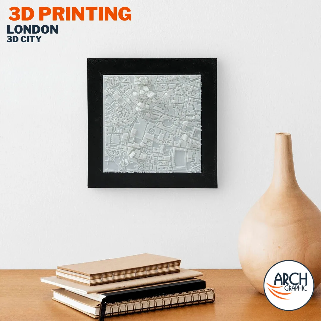
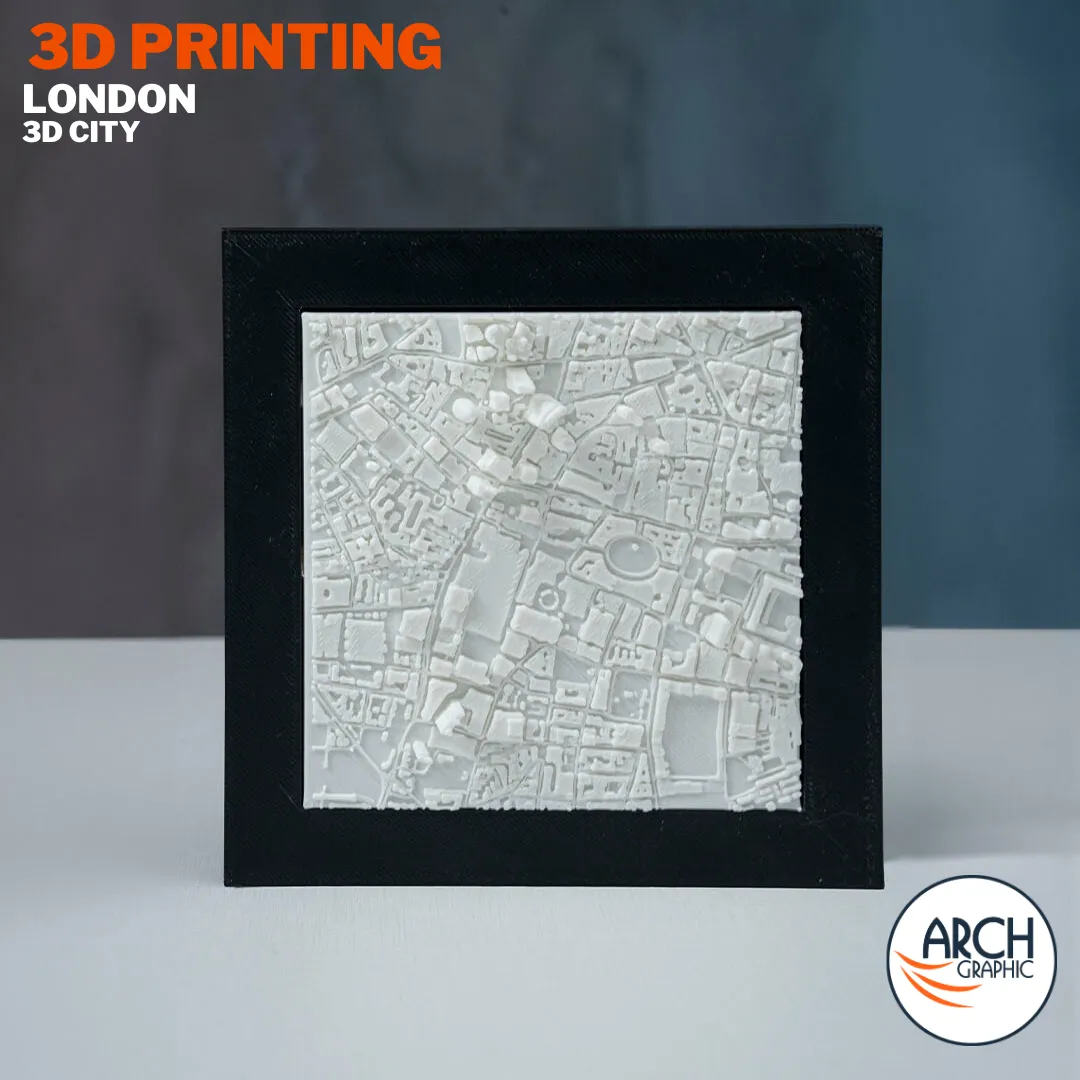
3D Printed London City Map — Relief Wall Art
A high-detail 3D printed relief map of London, capturing the Thames river bends, the City of London, Canary Wharf tower cluster, and the vast organic urban fabric that makes London unlike any other capital city. Centuries of growth — rendered in physical 3D relief. Printed in-house at our 3D printing facility in Sharjah — available in 18 PLA colors and delivered across the UAE and GCC within 4–6 business days.
| 2–3 Print days |
2–3 Delivery days |
4–6 Total days |
420.00 AED
Description
3D Printed London City Map — Relief Wall Art
Product Specifications
Every detail you need before ordering.
| Product | London City Map |
| Material | PLA Filament |
| Dimensions | 38 × 38 × 3 cm |
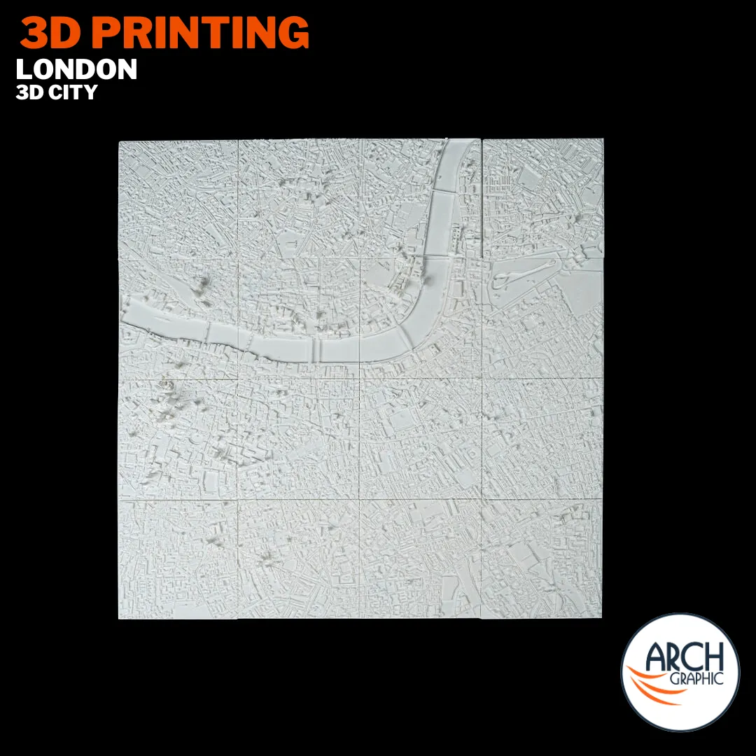
| Format | 16-tile assembled map |
| Available Colors | 18 standard PLA colors |
| Production | Made to order — Sharjah, UAE |
London — 3D City Map
3D Printed
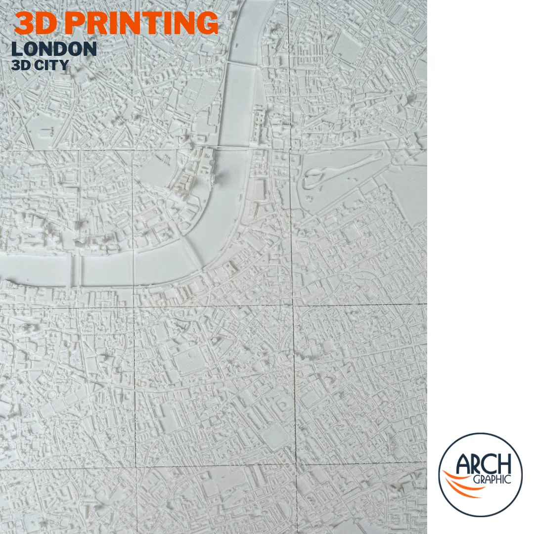
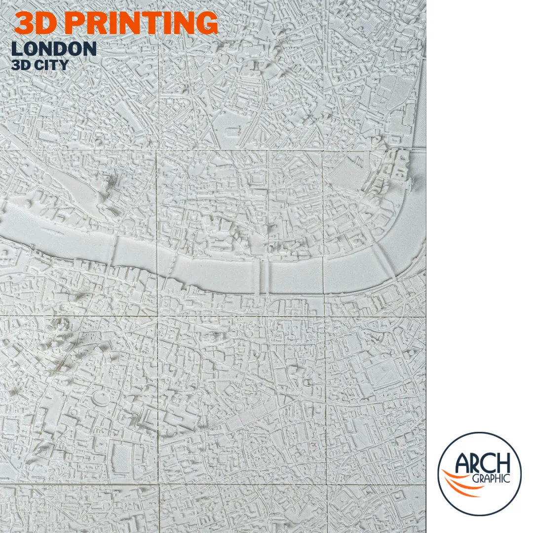
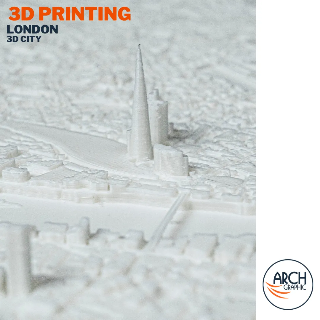
The 3D printed London city map from ARCH GRAPHIC captures one of the world’s oldest and most complex capital cities in full relief. London was never planned — it grew organically over two thousand years, and that history is written into its street network. No grid, no grand axes, no single centre — instead a layered urban fabric of medieval lanes, Victorian terraces, and modern tower clusters that together form one of the most richly detailed cities on earth. The Thames defines the city’s spine, curving east to west and separating north from south. In 3D relief, London’s organic complexity becomes something extraordinary. Available as part of our city maps collection.
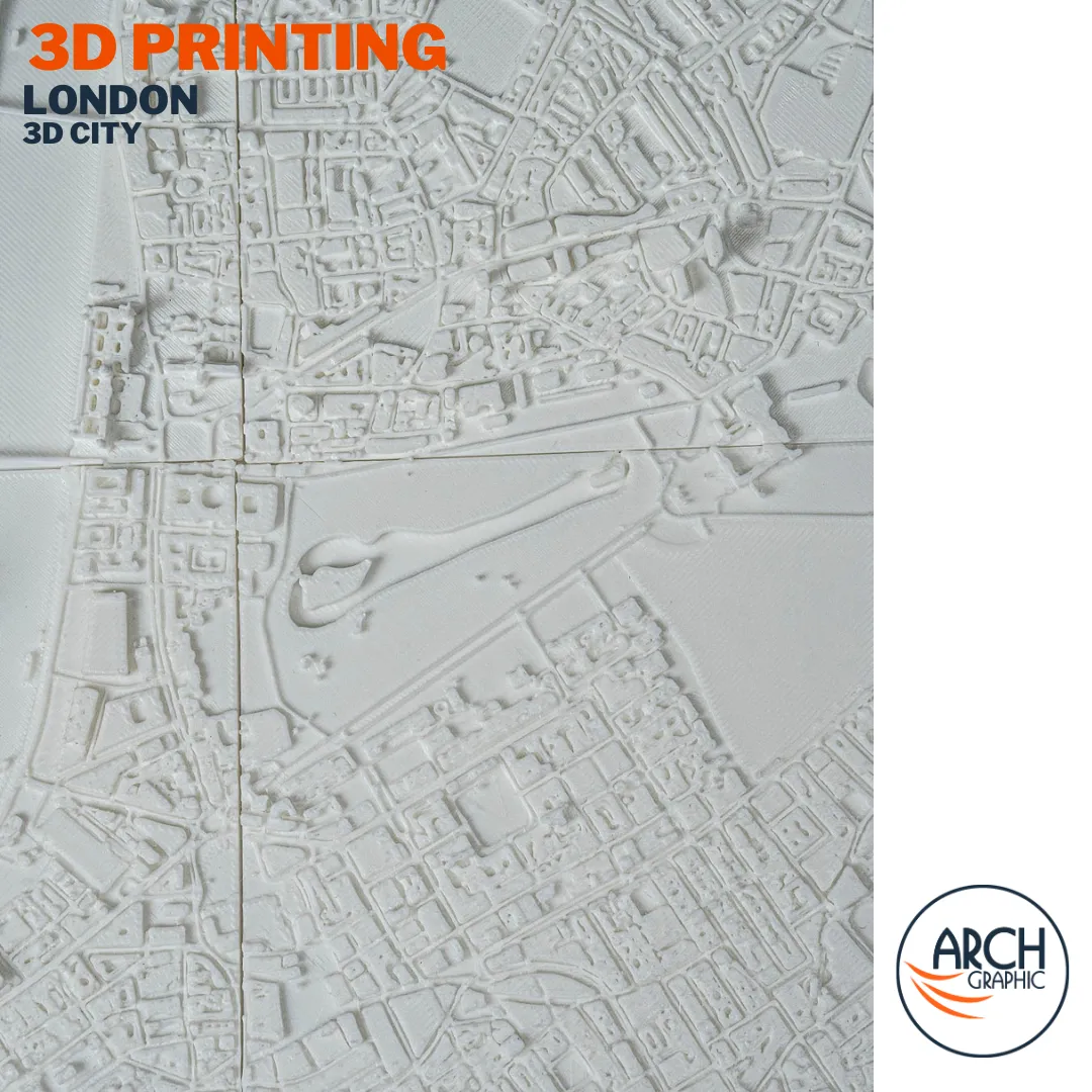
Using precision FDM 3D printing technology and accurate GIS urban data, this model reproduces London at architectural detail: the dense historic core of the City of London, the tower cluster of Canary Wharf rising from the Isle of Dogs, the open green spaces of Hyde Park and Regent’s Park, the South Bank cultural strip, and the Thames cutting its distinctive path through the entire map. The contrast between the tight medieval street network of the City and the wide Victorian boulevards of Westminster is one of the most readable features of this 3D printed architectural model.
Available in 18 PLA colors, this piece works as 3D printed wall art for architecture studios, corporate offices, and interior spaces — or as a premium gift for anyone with a connection to London. All orders are produced on demand at our 3D printing facility in Sharjah and delivered across the UAE and GCC. Browse our full range of 3D printed products or learn more about ARCH GRAPHIC.
- Architects and interior designers
- Travelers and expats with a connection to Amsterdam
- Unique gift for design and architecture lovers
- Premium gift for design and architecture lovers — see also our3D printed landmarks.
How It’s Made
London City Map
Urban Data Processing
Accurate GIS city data is processed into a 3D relief mesh — every building footprint, street width, and waterway preserved at full resolution.
Tile Preparation
The model is split into a 4-tile grid for precision FDM printing, ensuring detail is maintained evenly across the complete map area.
Print & Assembly
Each tile is printed at ARCH GRAPHIC’s Sharjah facility in your chosen PLA color, assembled, and quality-checked. Learn more about our 3D printing process.
Frequently Asked Questions
About
Additional information
| Dimensions | 38 × 38 × 10 cm |
|---|---|
| 3D Category | 3D City |
| 3D City | London |
| Material | |
| Print days | 2-3 Days |
| Delivery days | 2-3 Days |
| Production | Made to order — Sharjah, UAE |
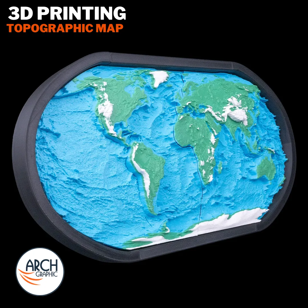 3D Printing Topographic Map Model
Reviews
There are no reviews yet.